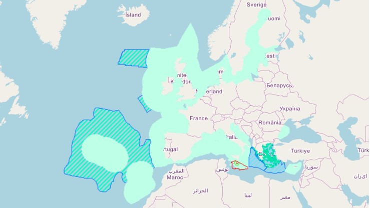
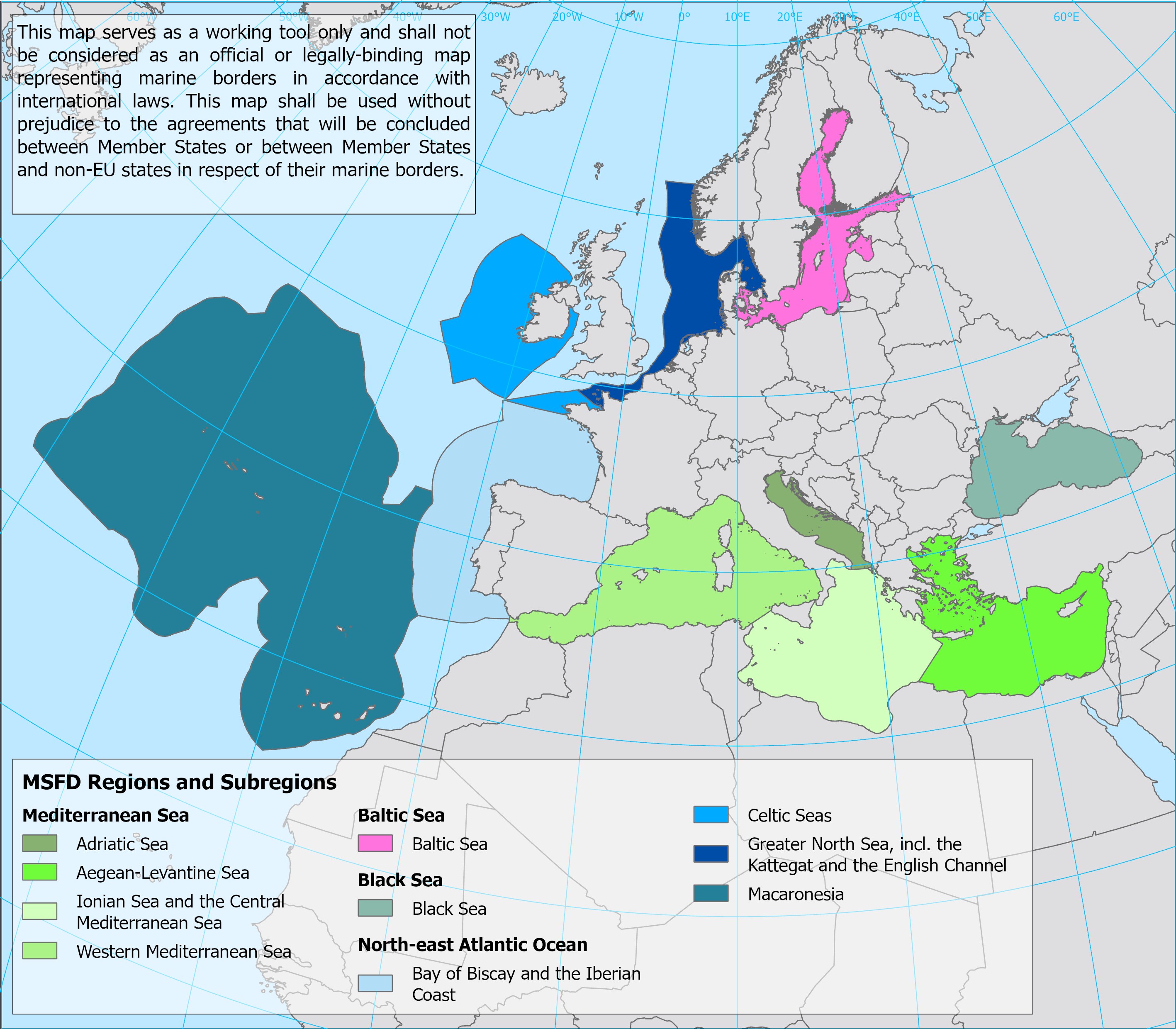
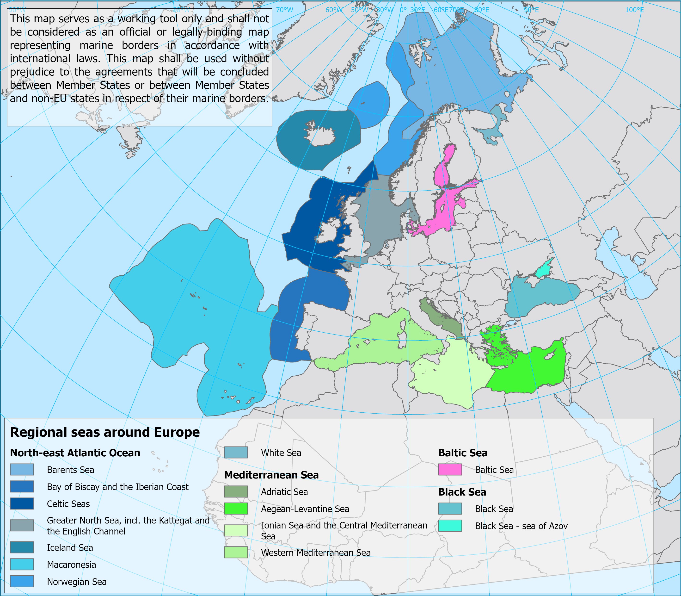
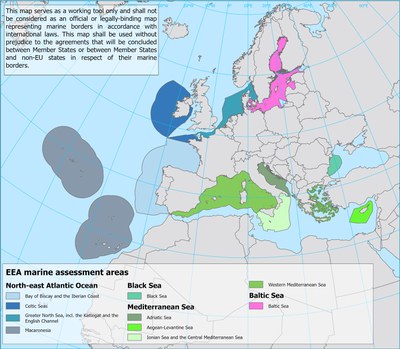
MSFD spatial reference datasetsThe present section makes available data and metadata of spatial datasets related with the Marine Strategy Framework Directive (MSFD) implementation, such as the marine regions and subregions, the national marine waters and the Marine Reporting Unit (MRU) provided by Member States and that represent the marine assessment areas requested by the Directive and linked to its Articles. This section offers also other spatial datasets, elaborated by the European Environment Agency (EEA) and the European Topic Centre (ETC) for statistical purposes and based on the above MSFD data.https://demo-water.devel5cph.eea.europa.eu/resources/msfd-reporting-data-tools/msfd-spatial-reference-datasetshttps://demo-water.devel5cph.eea.europa.eu/resources/msfd-reporting-data-tools/msfd-spatial-reference-datasets/@@images/image-1200-b6aaa9a9cdaa0b76d9ed3bd1460e72f4.jpegEU Marine Regions and Sub-regions. Source EEA
MSFD spatial reference datasets
The present section makes available data and metadata of spatial datasets related with the Marine Strategy Framework Directive (MSFD) implementation, such as the marine regions and subregions, the national marine waters and the Marine Reporting Unit (MRU) provided by Member States and that represent the marine assessment areas requested by the Directive and linked to its Articles. This section offers also other spatial datasets, elaborated by the European Environment Agency (EEA) and the European Topic Centre (ETC) for statistical purposes and based on the above MSFD data.
 marineregions_def.jpg